

HSE University Students Research Dangerous Natural Processes in Mountains

The Third Caucasus Summer School was recently held in the city of Ozurgeti (Georgia). It brought together two dozen students from different countries: the United Kingdom, Iran, Armenia, Georgia, Azerbaijan, Turkey, and Russia. Their main task was to analyse dangerous natural processes in the mountains and determine their impact on the development of local tourism.
Russia was represented by two students of HSE University’s Bachelor’s in Geography of Global Changes and Geoinformation Technology—Victoria Kabanova (third year) and Anastasia Shinkarik (fourth year)—as well a student from Lomonosov Moscow State University.

Anastasia Shinkarik
After learning about the school from their supervisor, the HSE University students decided to apply right away. ‘We have a group where teachers share information about interesting upcoming events in GIS, remote sensing, and other related areas,’ says Anastasia Shinkarik. ‘One of these events was the Third Caucasus Summer School in Georgia.’ The application process involved writing a letter of motivation, filling out a form to demonstrate the applicant’s knowledge of different types of computer programme, and submitting a recommendation from a supervisor and an English-language certificate.
The participants of the school studied dangerous natural processes in the mountains to determine how they affect the development of tourism in a particular area. They worked on group projects throughout the week and presented their results on the last day.

Victoria Kabanova
The young scientists also attended lectures and master classes from leading experts in the field of geodata. ‘This part was divided into two large blocks,’ said Victoria Kabanova. ‘The first unit was the study of dangerous natural processes in mountainous areas. We were also shown some methods of mapping and their identification based on various data. The second block was an introduction to tourism management in mountainous areas.’
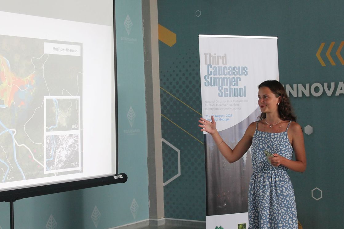
‘As you know, in terms of natural disasters, Georgia is in one of the most dangerous regions in the world. As a final project, we were asked to identify the location and nature of hazardous processes. Our team worked with a territory in which, according to remote sensing data, the remains of a past mudflow were identified,’ said Anastasia.
The school also hosted GeoQuest, a tournament in geographic orienteering. ‘We tried to find certain points by studying the data provided,’ recalls Victoria. ‘We were given six tasks; each of them had encrypted objects in Ozurgeti. We searched for each of them by coordinates, by a satellite image, by historical description, and so on.’
During the research, students carried out in-office data processing, which included decoding satellite images, studying digital terrain models, and mapping hazardous processes in the study area. The participants demonstrated their skills at working with GIS packages and Earth remote sensing data.
‘With the help of topographic maps and multi-temporal images of different satellite systems from 1972–2023, we were able to track the dynamics and predict potentially dangerous territories,’ concluded Anastasia.